

How Can Cities Adapt to Repeated Urban Flooding?
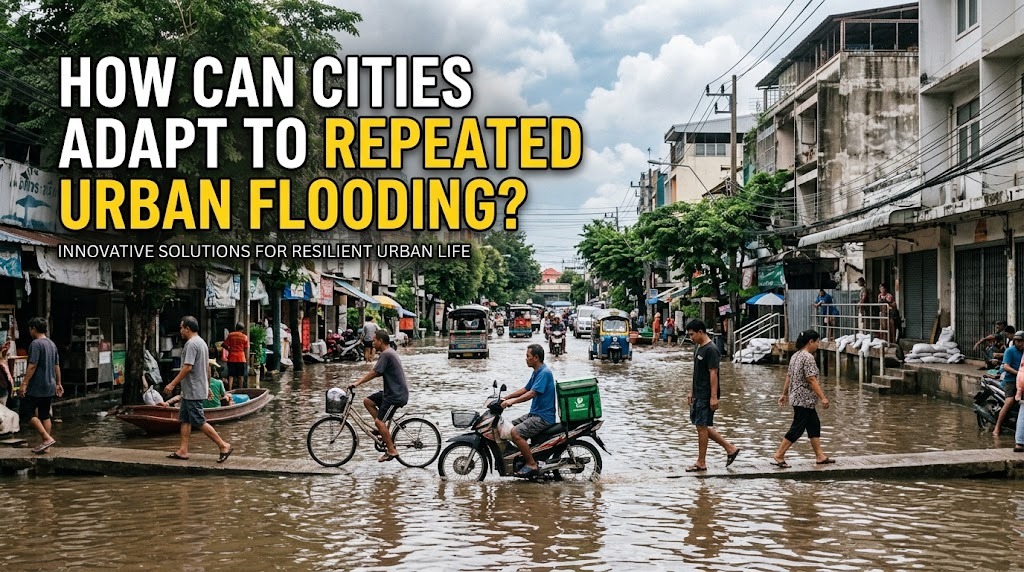
Repeated urban flooding presents a major challenge for cities as heavy rainfall, rapid urbanization, inadequate drainage, and changing climate conditions increase pressure on urban environments. Frequent floods can damage homes, disrupt transportation, affect businesses, and threaten public health. Instead of relying only on emergency responses after a flood occurs, cities need long-term adaptation strategies that reduce vulnerability and help communities recover more quickly. By improving infrastructure, protecting natural environments, strengthening urban planning, and involving residents, cities can become more resilient to recurring floods.
IMPROVING URBAN DRAINAGE SYSTEMS
Effective drainage systems are essential for managing rainwater in densely populated areas. Cities can adapt to repeated flooding by expanding drainage capacity, repairing damaged channels, and regularly removing sediment and waste that block water flow. Properly maintained drainage networks help direct excess rainwater away from residential areas, roads, and commercial districts.
However, drainage improvements must be based on local conditions and future rainfall projections. Simply increasing the size of drainage channels may transfer excess water to other neighborhoods if downstream systems cannot handle the additional flow. Therefore, cities should coordinate drainage upgrades with river management, water storage facilities, and wider flood control plans.
DEVELOPING GREEN INFRASTRUCTURE
Green infrastructure helps cities manage rainwater by allowing more water to infiltrate into the ground or remain temporarily stored in natural and designed landscapes. Parks, urban forests, rain gardens, green roofs, and permeable pavements can reduce surface runoff and ease pressure on conventional drainage systems. These features can also improve air quality, provide recreational spaces, and reduce urban heat.
Cities can incorporate green infrastructure into new developments and existing neighborhoods. For example, parking areas can use permeable materials, while public spaces can include rain gardens that collect runoff during storms. Although these solutions may not prevent every flood, combining them with conventional drainage and storage systems can improve the overall ability of cities to manage heavy rainfall.
PROTECTING RIVERS AND NATURAL WATERWAYS
Rivers, wetlands, and other natural waterways play an important role in absorbing, storing, and transporting excess water. When these areas are narrowed, filled, or obstructed by development, their ability to manage high water levels can decrease. Protecting natural waterways can therefore help reduce flood risks and maintain the ecological functions of urban environments.
Cities can establish protected river corridors, restore degraded wetlands, and prevent construction in areas that naturally store floodwater. Removing accumulated waste and sediment may also improve water flow where appropriate. These measures should be supported by scientific assessments because river conditions, floodplain characteristics, and downstream impacts vary between locations.
ADAPTING URBAN PLANNING AND LAND USE
Urban planning strongly influences how vulnerable a city becomes to repeated flooding. Construction on floodplains, wetlands, and other low-lying areas can expose more people and buildings to water-related hazards. Cities can reduce this exposure by directing new development toward lower-risk locations and limiting activities in areas that regularly experience dangerous inundation.
Land-use regulations should consider flood-risk maps, rainfall patterns, river behavior, and projected changes in climate conditions. In highly vulnerable locations, governments may need to restrict new construction, preserve open spaces, or gradually relocate essential facilities and households when other protective measures are insufficient. Effective planning also requires coordination between housing, transportation, environmental management, and public infrastructure departments.
BUILDING FLOOD-RESILIENT INFRASTRUCTURE
Cities can adapt by designing buildings, roads, utilities, and public facilities to withstand flooding more effectively. Depending on local risks, buildings may use elevated electrical systems, flood-resistant materials, raised entrances, and protected equipment areas. Critical facilities such as hospitals, emergency centers, and power installations should receive particular attention because their failure can affect large parts of the community.
Roads, bridges, and transportation networks can also be improved to reduce disruption during floods. Engineers may raise vulnerable road sections, strengthen drainage structures, and provide alternative routes for emergency vehicles. Infrastructure decisions should account for both the expected severity of flooding and the consequences of service interruptions, ensuring that investments protect essential functions rather than focusing only on visible damage.
USING TECHNOLOGY FOR FLOOD MONITORING
Modern technology can help cities detect flood risks earlier and respond more efficiently. Rain gauges, river-level sensors, weather forecasts, geographic information systems, and satellite observations can provide information about changing conditions. When these data sources are combined, authorities can identify vulnerable areas and estimate where flooding may occur.
Real-time monitoring can also support operational decisions, such as closing dangerous roads, deploying emergency personnel, and preparing temporary shelters. Digital flood maps can help residents understand local risks and plan evacuation routes. Nevertheless, technology is most effective when monitoring equipment is maintained, information is reliable, and public officials have clear procedures for acting on warnings.
STRENGTHENING EARLY WARNING AND EMERGENCY PREPAREDNESS
Repeated flooding requires cities to prepare for emergencies before heavy rainfall begins. Authorities can establish warning systems that communicate flood information through mobile alerts, public announcements, community networks, and local media. Messages should explain the expected danger, affected locations, recommended actions, and available evacuation routes.
Emergency preparedness also involves regular drills, accessible shelters, trained response teams, and plans for residents who need additional assistance. Communities should know where to obtain reliable information and how to protect essential documents, medicines, and emergency supplies. Clear communication is particularly important during severe weather, when electricity outages or disrupted telecommunications may limit access to digital alerts.
INVOLVING COMMUNITIES IN FLOOD ADAPTATION
Residents can contribute valuable local knowledge about flood depth, water movement, blocked drains, and areas that become inaccessible during heavy rainfall. City governments can use this information to identify recurring problems and improve neighborhood-level flood management. Community participation also helps ensure that adaptation measures address the needs of people who experience flooding most frequently.
Practical activities include reporting drainage blockages, participating in neighborhood cleanups, maintaining shared green spaces, and joining emergency preparedness programs. However, communities should not be expected to replace essential public infrastructure or carry the full responsibility for flood prevention. Effective adaptation requires sustained government investment, clear responsibilities, and cooperation between residents, businesses, and public institutions.
FINANCING LONG-TERM FLOOD ADAPTATION
Adapting to repeated flooding requires consistent funding for infrastructure upgrades, maintenance, environmental restoration, and emergency services. Cities can prioritize projects by assessing the number of people protected, the value of infrastructure at risk, the potential reduction in damage, and the needs of vulnerable communities. This approach helps governments allocate limited resources more effectively.
Funding may come from municipal budgets, national government programs, development partnerships, and other appropriate financing mechanisms. Cities should also evaluate the long-term costs of delaying action, including repeated repairs, lost business activity, and damage to public services. Transparent budgeting and regular project evaluation can help ensure that adaptation investments produce lasting benefits.
LEARNING FROM FLOOD EVENTS
Every flood provides information that can improve future planning. After an event, city authorities can examine rainfall records, flood depths, drainage performance, emergency response times, property damage, and community feedback. These findings can reveal weaknesses in existing systems and identify which measures performed as expected.
Cities should update flood-risk maps and adaptation plans as new evidence becomes available. Changes in land use, population growth, infrastructure conditions, and rainfall patterns can alter the level of risk over time. A continuous cycle of monitoring, evaluation, and improvement allows urban flood management to respond to changing conditions rather than relying on outdated assumptions.
CONCLUSION
Cities can adapt to repeated urban flooding by combining stronger drainage systems, green infrastructure, protected waterways, resilient buildings, improved urban planning, and reliable early warning systems. Community participation, adequate funding, and continuous evaluation are equally important for making these strategies effective. No single measure can eliminate every flood risk, particularly during extreme rainfall, but coordinated adaptation can reduce damage and improve recovery. By planning for recurring hazards instead of reacting only after disasters occur, cities can protect residents, support economic stability, and build more resilient urban environments.
Recent Posts

Bagaimana Sistem SKS pada Program Kuliah... 22.11.2026/54 View

How Does Technology Make Daily Evaluation... 21.11.2026/83 View

Apa Strategi Menghadapi Kesenjangan antara Kompetensi... 21.11.2026/82 View

Mengapa Inventaris Aset Penting bagi Kelancaran... 21.11.2026/78 View

When Should Musicians Join a Record... 21.11.2026/84 View
