

How Can Mapping Robots Explore Dangerous Underground Caves?
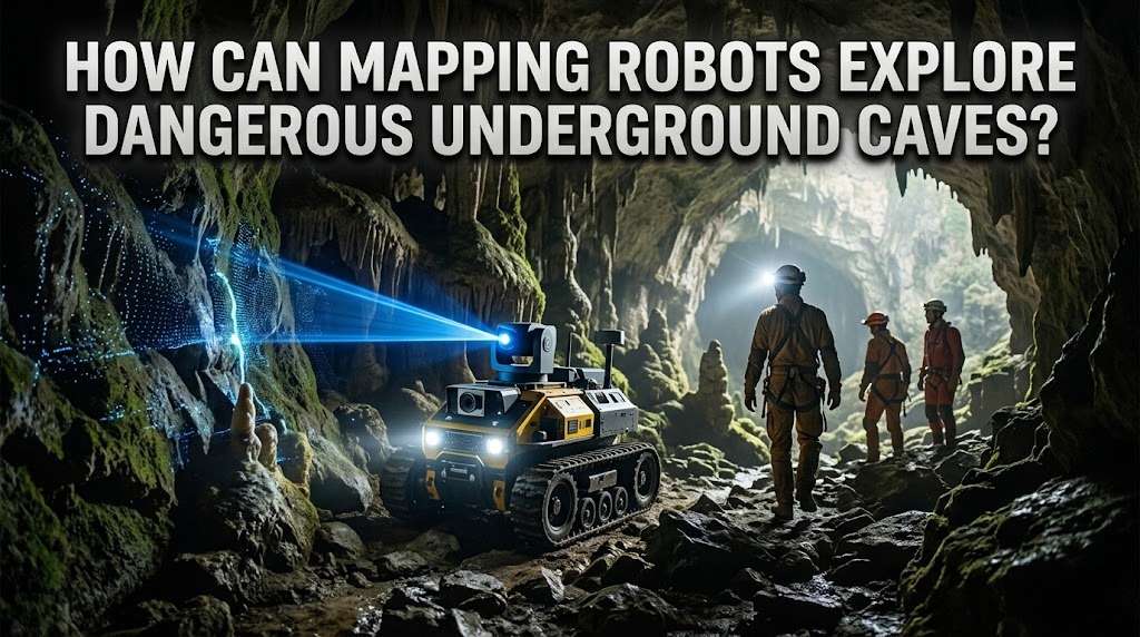
Underground caves can contain narrow passages, unstable rock formations, deep pits, flooding, and areas with limited oxygen. These conditions make exploration dangerous for humans, especially when cave layouts are unknown. Mapping robots offer a safer way to investigate such environments by collecting spatial data, identifying obstacles, and creating detailed maps. Equipped with specialized sensors and autonomous navigation systems, these robots help researchers and rescue teams understand underground spaces without exposing people to every hazard.
HOW MAPPING ROBOTS NAVIGATE UNDERGROUND CAVES
Mapping robots navigate caves using a combination of wheels, tracks, articulated legs, or other movement mechanisms designed for uneven terrain. Their onboard computers process sensor information to estimate their position and determine suitable paths. Some robots follow commands from remote operators, while others navigate independently through previously unexplored passages. Because underground environments often lack GPS signals, robots must rely on onboard sensing and localization techniques to understand where they are.
USING SENSORS TO CREATE DETAILED MAPS
Mapping robots use sensors such as LiDAR, stereo cameras, depth cameras, and inertial measurement units to collect information about their surroundings. LiDAR measures distances by analyzing reflected laser pulses, allowing the robot to estimate the shape of cave walls and passageways. Cameras capture visual details, while inertial sensors measure changes in orientation and movement. The robot combines these measurements to create three-dimensional maps that show tunnels, chambers, obstacles, and changes in elevation.
SIMULTANEOUS LOCALIZATION AND MAPPING
Simultaneous localization and mapping, commonly known as SLAM, is an important technique for robotic cave exploration. It allows a robot to estimate its position while building a map of an unfamiliar environment. As the robot moves through tunnels, it compares new sensor measurements with previously observed features to reduce uncertainty about its location. SLAM is especially useful when GPS is unavailable, but it can become less reliable in featureless passages, dusty environments, or areas where sensor readings are difficult to interpret. Reliable mapping may require multiple sensors and careful processing of collected data.
OVERCOMING PHYSICAL AND ENVIRONMENTAL HAZARDS
Underground caves present physical obstacles that can challenge robotic movement. Loose rocks, steep slopes, narrow openings, mud, and water can prevent a robot from reaching certain areas. Engineers address these conditions by selecting suitable locomotion systems, protective enclosures, and traction mechanisms. Waterproofing may be necessary for wet caves, while rugged frames help protect equipment from impacts. Robots must also monitor battery levels and maintain a reliable recovery plan in case they become trapped or lose communication.
DETECTING ENVIRONMENTAL DANGERS
Mapping robots can carry additional sensors to measure environmental conditions that affect human safety. Depending on their equipment, they may detect temperature, humidity, oxygen concentration, carbon dioxide, or certain hazardous gases. These measurements can help identify areas that require further investigation before people enter. Thermal cameras may also reveal temperature differences associated with water flow or nearby heat sources, although such observations do not automatically identify a specific hazard. Sensor selection must match the environmental risks, and measurements should be interpreted according to the limitations of each instrument.
SUPPORTING SEARCH AND RESCUE OPERATIONS
Robotic cave mapping can help rescue teams understand the layout of underground passages before sending personnel into difficult areas. Robots can inspect blocked routes, locate potential openings, and transmit images or map data to operators. In some situations, they may help identify hazards such as unstable sections or flooded passages. However, communication signals can weaken significantly underground, especially around bends and thick rock formations. Tethered communication systems, relay devices, or onboard autonomous navigation may be needed to maintain effective operations.
REMOTE CONTROL AND AUTONOMOUS EXPLORATION
Remote-controlled robots allow operators to guide movement while viewing camera feeds and sensor readings. This approach provides direct human oversight but may be limited by communication delays, poor visibility, or signal loss. Autonomous robots can continue mapping when communication is interrupted by using onboard navigation and decision-making systems. Some platforms combine both approaches, switching between autonomous movement and remote control when needed. The appropriate operating mode depends on cave complexity, mission objectives, and the consequences of navigation errors.
CHALLENGES IN ROBOTIC CAVE MAPPING
Despite their advantages, cave-mapping robots face several technical limitations. Dust, moisture, reflective surfaces, and low light can affect certain sensors, while narrow passages may restrict movement and scanning angles. Battery capacity limits exploration time, and complex terrain can increase the risk of mechanical failure. Mapping errors may also accumulate as the robot travels long distances without recognizable landmarks. Engineers must balance sensor performance, robot size, mobility, power consumption, and reliability when designing systems for underground exploration.
THE FUTURE OF UNDERGROUND MAPPING ROBOTS
Future cave-mapping robots may combine advanced LiDAR, artificial intelligence, multi-robot coordination, and improved autonomous navigation. Multiple robots could explore separate passages and combine their maps to produce a broader representation of an underground network. AI-assisted systems may also help classify geological features, detect changes in cave structure, and identify potentially hazardous regions. More efficient batteries and rugged components could extend exploration time and improve reliability. These advances may benefit geology, archaeology, environmental monitoring, and disaster-response operations.
CONCLUSION
Mapping robots can explore dangerous underground caves by navigating difficult terrain, collecting sensor data, and building detailed maps without requiring immediate human entry. Technologies such as LiDAR, SLAM, environmental sensors, and autonomous control help robots investigate unfamiliar passages and identify potential hazards. Although limited communication, battery life, and challenging terrain remain obstacles, robotic mapping can improve exploration efficiency and support safer decisions for researchers and rescue teams.
Recent Posts

Bagaimana Sistem SKS pada Program Kuliah... 22.11.2026/49 View

How Does Technology Make Daily Evaluation... 21.11.2026/77 View

Apa Strategi Menghadapi Kesenjangan antara Kompetensi... 21.11.2026/78 View

Mengapa Inventaris Aset Penting bagi Kelancaran... 21.11.2026/74 View

When Should Musicians Join a Record... 21.11.2026/79 View
