

How Can Technological Innovation Help Monitor Climate Change?
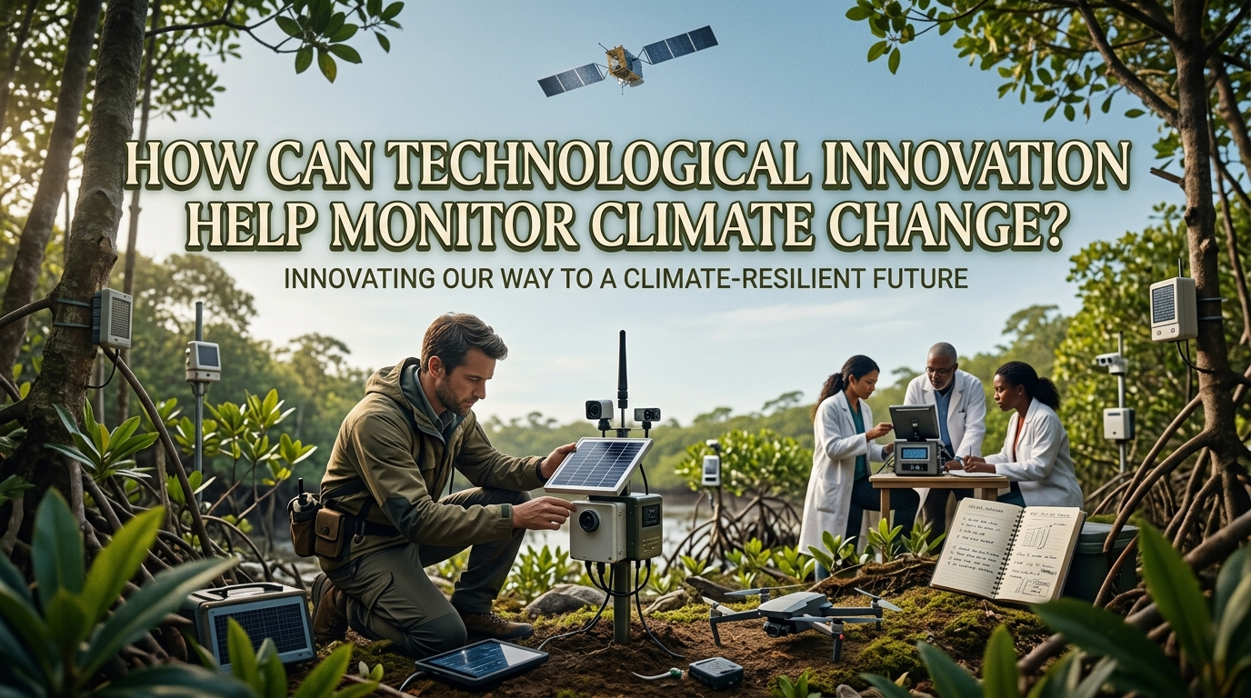
Climate change is a major environmental challenge that requires accurate information and continuous monitoring. Rising temperatures, changing rainfall patterns, melting glaciers, and increasing sea levels affect ecosystems and human communities around the world. Understanding these changes helps scientists and governments develop effective solutions. Technological innovation makes climate monitoring faster, more accurate, and more accessible by providing tools to collect and analyze environmental data. Technologies such as satellites, artificial intelligence, weather sensors, and computer models help researchers understand climate patterns and predict potential risks. With reliable information, communities can prepare for environmental changes and make better decisions to protect the planet.
USING SATELLITES TO OBSERVE CLIMATE CHANGE
Satellites are among the most important technologies for monitoring climate change because they can observe large areas of Earth from space. They collect information about land temperatures, ocean conditions, cloud cover, vegetation, and ice coverage. Scientists use these observations to identify long-term environmental changes that may not be visible from a single location. For example, satellite images can reveal melting glaciers, shrinking forests, and changes in sea levels. These observations help researchers understand how the Earth's climate system is changing over time.
Satellite monitoring also allows scientists to compare environmental conditions across different regions. This is especially useful in remote areas where ground-based measurements are limited or difficult to obtain. By combining satellite observations with information from weather stations and ocean instruments, researchers can improve the accuracy of climate assessments. However, satellite measurements require careful calibration and scientific analysis to ensure reliable results. Satellite technology provides valuable evidence for understanding climate change and supporting environmental planning.
USING ARTIFICIAL INTELLIGENCE TO ANALYZE CLIMATE DATA
Artificial intelligence (AI) can help scientists process large amounts of climate data more efficiently. Climate monitoring involves information from satellites, weather stations, ocean sensors, and other sources, which can be difficult to analyze manually. AI algorithms can identify patterns, detect unusual changes, and help researchers understand relationships between environmental conditions. For example, AI tools can assist in identifying changes in temperature, tracking deforestation, and analyzing patterns associated with extreme weather. These capabilities can make climate research faster and help scientists focus on important environmental trends.
AI can also support climate forecasting when combined with reliable data and established scientific models. It may help researchers improve predictions of certain weather events, estimate future environmental risks, and identify areas that require closer monitoring. However, AI systems are not always accurate, especially when training data are limited or conditions differ from past observations. Their results must be evaluated by experts and compared with scientific evidence. Combining AI with climate science can improve monitoring while maintaining the importance of accuracy and human judgment.
MONITORING WEATHER WITH SMART SENSORS
Smart sensors help collect environmental measurements continuously from specific locations. These devices can measure air temperature, humidity, rainfall, wind speed, soil moisture, and other important conditions. When connected to digital communication systems, they can send information to researchers and monitoring centers in near real time. This allows scientists to observe local environmental changes and compare them with historical records. Real-time environmental monitoring can help identify unusual conditions before they develop into more serious problems.
Smart sensors are useful in cities, forests, agricultural areas, and coastal communities. For example, soil moisture sensors can help farmers understand changing water conditions, while temperature sensors can identify areas experiencing extreme heat. Networks of sensors can also support early warning systems for floods and other weather-related hazards. However, sensors need regular maintenance, reliable power supplies, and proper calibration to produce dependable measurements. Connected sensor networks provide detailed local information that complements satellite observations and broader climate models.
USING CLIMATE MODELS TO PREDICT FUTURE CHANGES
Climate models are computer-based tools that simulate interactions between the atmosphere, oceans, land, ice, and other parts of the climate system. Scientists use these models to study how the climate may respond to different levels of greenhouse gas emissions. By combining observations with physical scientific principles, models can estimate possible future temperature changes, rainfall patterns, and sea-level rise. These projections help governments understand potential climate risks and develop long-term plans. Climate modeling is therefore an important tool for preparing for future environmental conditions.
Technological improvements in computing allow researchers to run more detailed simulations and examine different climate scenarios. These models can help communities assess risks to agriculture, water supplies, infrastructure, and coastal areas. However, climate projections are not exact predictions of every future event. Their results depend on assumptions about future emissions, natural processes, and the quality of available data. Scientists often compare several models to understand uncertainty and identify common findings. Reliable climate projections help decision-makers prepare for possible outcomes instead of relying only on past weather patterns.
USING DRONES TO MONITOR LOCAL ENVIRONMENTS
Drones provide another way to collect detailed environmental information from areas that are difficult to observe on foot. Equipped with cameras and specialized sensors, they can capture images of forests, coastlines, wetlands, farms, and damaged landscapes. Researchers can use these images to measure vegetation changes, identify forest damage, and observe the effects of drought or flooding. Drones can also survey locations where traditional fieldwork is expensive or dangerous. Drone technology makes local environmental monitoring more flexible and detailed.
Drones are particularly useful when researchers need high-resolution information about a specific location. For example, they can help monitor the recovery of restored forests or identify erosion along vulnerable coastlines. When repeated surveys are conducted under suitable conditions, scientists can compare the results to measure environmental changes over time. Nevertheless, drones cover smaller areas than satellites and may be limited by weather, battery life, regulations, and operating costs. Combining drone surveys with satellite data gives researchers both detailed local observations and a broader view of environmental change.
IMPROVING OCEAN AND SEA LEVEL MONITORING
The oceans absorb much of the excess heat trapped by greenhouse gases and also absorb a significant amount of human-produced carbon dioxide. Monitoring ocean conditions is therefore essential for understanding climate change. Scientists use ocean buoys, underwater instruments, satellites, and research vessels to measure sea temperatures, currents, salinity, and other important variables. Tide gauges and satellite altimeters help researchers track changes in sea level. These measurements reveal how the oceans are responding to a warming climate.
Ocean monitoring can also help researchers understand marine heatwaves, changing ocean circulation, and conditions that contribute to coral bleaching. Long-term observations allow scientists to distinguish temporary fluctuations from more persistent climate trends. This information is valuable for coastal planning, marine conservation, and fisheries management. However, collecting ocean data can be expensive, and some regions remain poorly monitored. Improved ocean observation systems can fill important information gaps and help coastal communities prepare for rising sea levels and other marine climate risks.
MAKING CLIMATE DATA ACCESSIBLE TO COMMUNITIES
Collecting climate data is only useful when people can understand and apply the information. Digital dashboards, online maps, mobile applications, and public information platforms can present complex environmental measurements in clear formats. Governments and researchers can use these tools to share temperature trends, rainfall information, flood risks, and other climate indicators. Accessible climate data helps communities understand local environmental challenges and make informed decisions.
Farmers can use climate information to adjust planting schedules, while city planners can identify areas that need better drainage or additional shade. Schools and environmental organizations can also use digital tools to educate the public about climate change. However, reliable access to electricity, internet connections, digital skills, and understandable information remains limited in some communities. Governments and organizations should therefore provide accessible formats and support for people who face technological barriers. Open and understandable climate information can encourage public participation and strengthen local preparedness.
CHALLENGES OF USING TECHNOLOGY FOR CLIMATE MONITORING
Although technological innovation offers many benefits, climate monitoring still faces several challenges. Advanced satellites, sensor networks, research equipment, and computing systems can be expensive to develop and maintain. Some regions lack the technical expertise, reliable infrastructure, or funding needed to use these tools effectively. Differences in measurement methods can also make data from different sources difficult to compare. Reliable climate monitoring requires investment, consistent standards, and skilled researchers.
Another challenge is ensuring that collected information is accurate, secure, and available to the people who need it. Equipment failures, incomplete records, and technical errors can affect monitoring results. Scientists must validate measurements and explain uncertainties so that decision-makers do not misunderstand the findings. International cooperation can help countries share data, research methods, and technical knowledge. Combining different technologies with scientific validation and global cooperation can make climate monitoring more dependable and widely available.
CONCLUSION
Technological innovation helps monitor climate change by allowing scientists to observe environmental conditions, analyze large datasets, and estimate future climate risks. Satellites, artificial intelligence, smart sensors, climate models, drones, and ocean monitoring systems each provide valuable information. When these technologies work together, they create a more complete understanding of changes affecting the planet. However, accurate data, regular maintenance, scientific validation, and accessible information remain essential for effective monitoring. By investing in reliable technology and sharing climate knowledge, countries and communities can make better decisions and develop stronger strategies to address climate change.
Recent Posts
Bagaimana Sistem SKS pada Program Kuliah... 22.11.2026/51 View

How Does Technology Make Daily Evaluation... 21.11.2026/81 View

Apa Strategi Menghadapi Kesenjangan antara Kompetensi... 21.11.2026/81 View

Mengapa Inventaris Aset Penting bagi Kelancaran... 21.11.2026/77 View

When Should Musicians Join a Record... 21.11.2026/82 View
