

How Can Technology Help Predict Urban Flood Risks?
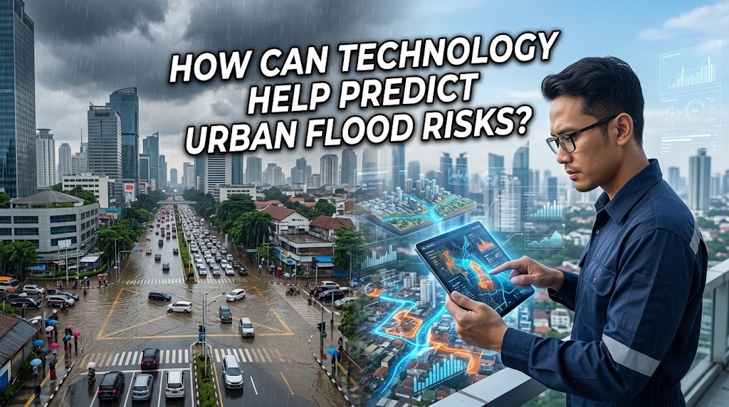
Urban flooding is a growing concern for cities experiencing heavy rainfall, rapid development, and changing weather patterns. Floods can damage buildings, disrupt transportation, threaten public safety, and cause significant economic losses. Technology can help cities identify potential flood hazards before they become emergencies by collecting environmental data, analyzing rainfall patterns, and monitoring water levels. When combined with accurate information and effective emergency planning, these tools can improve flood preparedness and help communities respond more quickly.
USING WEATHER FORECASTING TO PREDICT HEAVY RAINFALL
Weather forecasting technology helps meteorologists estimate when and where heavy rainfall may occur. Weather satellites, radar systems, rain gauges, and atmospheric models provide information about clouds, precipitation, wind, and developing storms. By analyzing these observations, forecasting systems can identify weather conditions that may increase the likelihood of urban flooding.
Accurate rainfall forecasts help local authorities prepare drainage systems, alert emergency services, and inform residents about possible hazards. For example, forecasts of intense rainfall may prompt officials to monitor flood-prone roads and prepare evacuation arrangements. Although weather forecasts cannot predict every storm precisely, improvements in data collection and modeling can support earlier and better-informed decisions.
MONITORING WATER LEVELS WITH SENSORS
Water-level sensors can measure changes in rivers, canals, reservoirs, and drainage channels. These devices collect information that helps authorities determine whether water levels are rising toward dangerous thresholds. Some systems transmit measurements automatically to monitoring centers, allowing officials to observe changing conditions without visiting every location.
When sensors detect rapidly rising water, automated systems can send alerts to responsible agencies. This information can help emergency teams identify locations that require immediate attention and prepare warnings for nearby communities. Regular maintenance and reliable communication networks are necessary to ensure that sensors continue working accurately during severe weather.
USING ARTIFICIAL INTELLIGENCE FOR FLOOD PREDICTION
Artificial intelligence can help analyze large amounts of information from weather stations, river sensors, satellite observations, and historical flood records. Machine learning models can identify relationships between rainfall intensity, land characteristics, drainage capacity, and previous flooding events. These patterns may help estimate which areas are more likely to experience flooding under particular conditions.
AI-based systems can also process incoming data to update predictions as weather and water levels change. However, their accuracy depends on the quality and completeness of the data used to develop and operate them. Predictions may be less reliable in locations with limited historical records or rapidly changing urban landscapes, so AI should support rather than replace expert assessment.
USING GEOGRAPHIC INFORMATION SYSTEMS AND FLOOD MAPS
Geographic Information Systems, commonly known as GIS, allow planners to combine spatial information from different sources. These systems can display elevation, river networks, drainage infrastructure, land use, population distribution, and historical flood locations on digital maps. By examining these layers together, authorities can identify areas that may be particularly vulnerable to flooding.
Digital flood maps can help governments prioritize drainage improvements, guide development decisions, and plan evacuation routes. They can also show which roads, schools, hospitals, and residential areas may be exposed to flood hazards. To remain useful, these maps must be updated as cities expand, infrastructure changes, and new information becomes available.
APPLYING SATELLITE IMAGERY AND REMOTE SENSING
Satellite imagery provides a broad view of urban landscapes and changing environmental conditions. Remote sensing technology can help monitor rainfall, surface water, soil moisture, land cover, and changes in river or coastal conditions. Comparing images collected at different times can reveal where urban development has replaced vegetation or where floodwater has spread.
During and after a flood, satellite observations can help authorities estimate the extent of inundated areas, particularly where ground access is difficult. This information supports emergency response, damage assessment, and future flood planning. However, cloud cover, image resolution, and the time required to obtain and process observations can limit the usefulness of some satellite data during rapidly developing emergencies.
CREATING FLOOD SIMULATIONS WITH COMPUTER MODELS
Computer models can simulate how water moves across urban landscapes during different rainfall scenarios. These models use information about terrain, rainfall intensity, soil conditions, drainage networks, and river flows to estimate where water may accumulate and how deep flooding could become. Some models also examine how proposed construction projects or drainage improvements might change flood patterns.
Flood simulations help engineers and city planners evaluate possible solutions before spending money on major infrastructure projects. For instance, a model can estimate whether a proposed retention basin may reduce flooding in a particular neighborhood or whether a drainage channel needs additional capacity. Model results remain estimates, so they should be checked against field measurements, historical events, and local engineering knowledge.
DEVELOPING REAL-TIME FLOOD WARNING SYSTEMS
Real-time flood warning systems combine information from weather forecasts, sensors, monitoring stations, and predictive models. When measurements or forecasts indicate that flood thresholds may be exceeded, the system can notify emergency managers and residents. Warnings may be delivered through mobile applications, text messages, sirens, public announcements, and official social media channels.
The timing and clarity of these warnings are essential. Residents need to understand which locations are at risk, how urgently they should act, and where they can obtain reliable updates. Warning systems should also provide accessible information for people with disabilities and those who may not have reliable internet access or smartphones.
USING SMART CITY TECHNOLOGY TO MANAGE DRAINAGE
Smart city systems can connect drainage infrastructure with digital monitoring and automated controls. For example, connected sensors can monitor water levels in drains and retention ponds, while control systems can operate pumps or adjust suitable water-control structures. This information helps operators understand how the drainage network is performing during periods of heavy rainfall.
Some cities can use connected systems to identify unusual water accumulation, detect equipment problems, and prioritize maintenance. Nevertheless, automated infrastructure must include appropriate safety controls, backup power, and manual operating procedures. Technology is most useful when it is integrated into a well-maintained drainage network rather than treated as a substitute for sound infrastructure design.
IMPROVING COMMUNITY PREPAREDNESS THROUGH DIGITAL TOOLS
Digital tools can help residents access flood forecasts, hazard maps, evacuation information, and emergency announcements. Mobile applications and official online dashboards may provide updates about rainfall, river levels, road closures, and nearby flood warnings. These tools can help people make informed decisions about travel, household safety, and evacuation.
Communities can also contribute information by reporting rising water, blocked drains, or flooded streets through verified reporting platforms. Such reports can supplement sensor data and help authorities identify local problems. However, information should be checked carefully because inaccurate reports or delayed updates may cause confusion during emergencies.
CHALLENGES OF USING TECHNOLOGY FOR FLOOD PREDICTION
Although technology can improve flood prediction, several challenges remain. Sensors may fail, communication networks may be interrupted, and weather models may not accurately represent highly localized rainfall. Cities with limited funding or insufficient technical expertise may also struggle to install and maintain monitoring systems.
Data quality, privacy, cybersecurity, and public access to warnings are additional considerations. Governments need trained personnel, regular equipment maintenance, reliable data management, and clear procedures for responding to alerts. Combining multiple information sources and maintaining backup communication methods can make flood prediction and warning systems more dependable.
CONCLUSION
Technology helps predict urban flood risks through weather forecasting, water-level sensors, artificial intelligence, satellite imagery, GIS mapping, and computer simulations. These tools allow governments to identify vulnerable areas, monitor changing conditions, and issue warnings before flooding causes serious damage. However, predictions are not always exact, and their effectiveness depends on reliable data, proper maintenance, and timely action. By combining technology with strong infrastructure, expert knowledge, and community preparedness, cities can improve their ability to manage flood risks and protect residents.
Recent Posts
Bagaimana Sistem SKS pada Program Kuliah... 22.11.2026/54 View
How Does Technology Make Daily Evaluation... 21.11.2026/83 View

Apa Strategi Menghadapi Kesenjangan antara Kompetensi... 21.11.2026/81 View
Mengapa Inventaris Aset Penting bagi Kelancaran... 21.11.2026/78 View

When Should Musicians Join a Record... 21.11.2026/82 View
