

How Can Urban Infrastructure Reduce Flood Impacts?
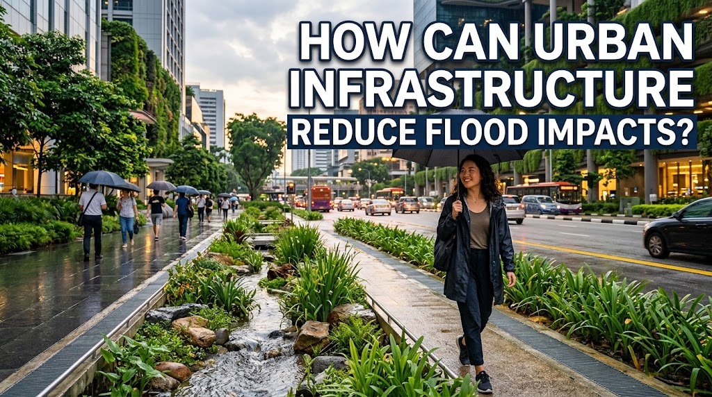
Urban flooding can cause serious damage to homes, businesses, transportation networks, and public facilities. Heavy rainfall, overflowing rivers, inadequate drainage, and rapid urban development can increase the amount of water accumulating in cities. Urban infrastructure plays an important role in reducing these impacts by controlling water movement, protecting vulnerable areas, and helping communities recover after floods. Through effective planning, modern engineering, and regular maintenance, cities can become more resilient to flooding.
IMPROVING DRAINAGE SYSTEMS
Drainage systems are essential for collecting and directing rainwater away from streets, buildings, and public spaces. Properly designed drains, underground pipes, canals, and pumping stations help move excess water toward rivers, reservoirs, or other suitable discharge points. When drainage systems function effectively, they can reduce the accumulation of water during rainfall.
However, drainage infrastructure may become overwhelmed when rainfall exceeds its design capacity. Blockages caused by waste and sediment can also prevent water from flowing efficiently. Governments can reduce these problems by upgrading drainage networks, cleaning channels regularly, and designing systems that account for local rainfall patterns and future flood risks.
BUILDING FLOOD BARRIERS AND PROTECTIVE STRUCTURES
Flood barriers, levees, embankments, and floodwalls can help protect urban areas from rising water levels. These structures are often used near rivers, coastal areas, and locations that experience recurring floods. When appropriately designed and maintained, they can reduce the likelihood of floodwater entering residential neighborhoods and important public facilities.
Protective structures must be planned carefully because they do not eliminate every flood hazard. Water may overtop barriers, pass through weak points, or accumulate behind protective structures when drainage is insufficient. Governments should evaluate local conditions, inspect infrastructure regularly, and combine physical barriers with drainage improvements, flood forecasting, and emergency planning.
DEVELOPING WATER STORAGE FACILITIES
Water storage facilities help manage excess rainwater by temporarily holding it before it enters drainage networks or rivers. Retention ponds, detention basins, reservoirs, and underground storage tanks can reduce the amount of water flowing through urban drainage systems at one time. These facilities are particularly useful when intense rainfall produces more runoff than the existing infrastructure can immediately transport.
Retention facilities generally hold water for longer periods, while detention facilities temporarily store water and release it gradually. Both approaches can reduce peak runoff when designed for local conditions. Regular inspections and sediment removal are important to maintain storage capacity and ensure that facilities remain effective during heavy rainfall.
USING PERMEABLE PAVEMENTS AND GREEN INFRASTRUCTURE
Traditional concrete and asphalt surfaces prevent much of the rainwater from entering the soil. As a result, large paved areas can produce substantial runoff that increases pressure on drainage networks. Permeable pavements and green infrastructure offer additional ways to manage this water closer to where rainfall occurs.
Permeable paving allows water to pass through specially designed surfaces into a storage layer beneath. Rain gardens, green roofs, urban trees, and vegetated drainage channels can also slow runoff, support infiltration, or temporarily retain rainwater. These solutions work best when their design matches local soil conditions, groundwater levels, maintenance capacity, and rainfall patterns.
PROTECTING RIVERS AND RESTORING FLOODPLAINS
Rivers provide important routes for moving water through and beyond urban areas. When channels become obstructed or floodplains are occupied by buildings, rivers may have less space to accommodate high water levels. This can increase the likelihood of flooding in nearby neighborhoods.
Infrastructure planning can help protect waterways by maintaining suitable river channels, restoring riverbank vegetation, and preserving floodplains where water can spread safely. Governments may also improve bridges, culverts, and drainage connections that restrict water movement. These projects should consider the entire watershed because changes that move water away from one neighborhood may increase flood risks elsewhere.
DESIGNING FLOOD-RESILIENT ROADS AND BRIDGES
Roads and bridges are essential for transportation, emergency services, and economic activity. During floods, these structures may become submerged, damaged, or inaccessible, preventing people from reaching hospitals, schools, workplaces, and evacuation points. Flood-resilient infrastructure can reduce these disruptions and help communities maintain essential connections.
Engineers can assess flood hazards when designing road elevations, bridge openings, culverts, and drainage features. In some locations, raising vulnerable road sections or improving water crossings may reduce the risk of prolonged closures. Safe alternative routes and clear road-closure procedures are also important because infrastructure cannot always remain accessible during severe flooding.
PROTECTING BUILDINGS AND ESSENTIAL PUBLIC FACILITIES
Buildings can be designed or modified to reduce flood damage. Measures may include elevating electrical equipment, installing suitable flood-resistant materials, improving site drainage, and placing important systems above expected flood levels. These measures can reduce repair costs and help buildings remain usable after floodwater recedes.
Hospitals, emergency centers, water treatment facilities, and power installations require particular attention because their failure can affect large populations. Governments should identify facilities located in flood-prone areas and develop appropriate protection or relocation plans where necessary. Protecting essential services helps maintain public health, safety, and emergency response capacity during disasters.
INSTALLING FLOOD MONITORING AND WARNING INFRASTRUCTURE
Flood monitoring infrastructure helps authorities understand changing conditions and identify potential hazards. Rainfall gauges, river-level sensors, weather radar, and monitoring stations can provide information about developing storms and rising water levels. These systems support decisions about when to issue warnings, deploy emergency teams, or close dangerous roads.
Early warning infrastructure is most effective when it is connected to clear response procedures. Authorities need reliable communication channels, updated flood maps, and accessible alerts so residents can take appropriate action. Backup power, equipment maintenance, and alternative communication methods are also necessary to keep warning systems operating during severe weather.
MAINTAINING INFRASTRUCTURE REGULARLY
Even well-designed infrastructure can become less effective without regular maintenance. Drains may accumulate sediment, pumps may malfunction, river channels may collect debris, and protective barriers may develop structural weaknesses. These problems can reduce the capacity of flood-control systems when they are needed most.
Governments can establish inspection schedules, monitor infrastructure conditions, and prioritize repairs based on local flood risks. Maintenance plans should also account for seasonal rainfall, equipment life cycles, and available funding. Consistent maintenance helps protect public investment and reduces the likelihood that preventable infrastructure failures will worsen flooding.
INTEGRATING INFRASTRUCTURE WITH URBAN PLANNING
Infrastructure alone cannot solve every urban flooding problem. Its effectiveness depends on how land is developed, where people live, and how water moves through the surrounding landscape. Constructing more roads and buildings without considering runoff can increase the pressure on drainage systems, even when individual projects include some flood protection.
Integrated urban planning combines drainage improvements, green spaces, water storage, flood hazard maps, and suitable land-use regulations. Governments can limit development in high-risk areas and require new projects to manage stormwater responsibly. Coordination between engineers, planners, environmental specialists, and local communities helps ensure that flood-control measures work together rather than shifting risks from one location to another.
CONCLUSION
Urban infrastructure can reduce flood impacts by improving drainage, storing excess rainwater, protecting buildings, strengthening transportation networks, and monitoring changing water levels. Green infrastructure, river restoration, and flood-resilient construction provide additional protection when integrated into wider urban planning. However, no single structure can prevent every flood, especially when rainfall exceeds design limits. A combination of appropriate engineering, environmental protection, regular maintenance, and effective emergency planning can help cities minimize damage and protect their communities.
Recent Posts

Bagaimana Sistem SKS pada Program Kuliah... 22.11.2026/54 View

How Does Technology Make Daily Evaluation... 21.11.2026/83 View

Apa Strategi Menghadapi Kesenjangan antara Kompetensi... 21.11.2026/82 View

Mengapa Inventaris Aset Penting bagi Kelancaran... 21.11.2026/78 View

When Should Musicians Join a Record... 21.11.2026/84 View
