

How Do Drones Improve Disaster Risk Mapping in Remote Areas?
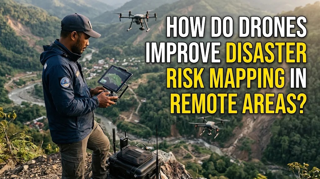
Remote areas often face challenges when collecting accurate information about potential disaster risks. Mountainous terrain, dense forests, isolated islands, and limited road access can make traditional surveying methods difficult, expensive, and time-consuming. As a result, important information about landslides, floods, damaged infrastructure, and vulnerable settlements may be incomplete or outdated.
Drones provide a practical way to collect aerial data from locations that are difficult to reach. Equipped with cameras and other sensors, these unmanned aerial vehicles can capture detailed images and geographical information from above. The data can then be processed into maps that help authorities identify hazards, assess vulnerable locations, and plan disaster risk reduction measures.
CAPTURING AERIAL IMAGES OF HARD-TO-REACH AREAS
Drones can fly over remote locations and capture images without requiring survey teams to travel across difficult terrain. This capability is particularly useful in mountainous regions, forests, coastal areas, and isolated settlements where access may be limited.
The collected images provide a broad view of the landscape, including rivers, slopes, roads, buildings, and surrounding vegetation. Survey teams can use this information to identify geographical features that may contribute to disaster risks. Aerial imagery also helps create updated maps when existing geographical information is incomplete or outdated.
IDENTIFYING LANDSLIDE-PRONE LOCATIONS
Landslides frequently occur in areas with steep slopes, unstable soil, vegetation loss, or heavy rainfall. Drones can capture detailed images of hillsides to help experts examine slope conditions and identify visible warning signs, such as cracks, soil movement, and changes in surface vegetation.
When equipped with suitable sensors, drones can also collect information that supports the analysis of terrain characteristics. Photogrammetry can transform overlapping aerial photographs into three-dimensional surface models, allowing specialists to examine elevation and slope patterns. These products support landslide risk mapping, although field inspections and geological assessments are still necessary to confirm ground conditions.
MAPPING FLOOD-PRONE AREAS
Flood risk mapping requires information about river channels, elevation, drainage networks, and nearby settlements. Drones can capture aerial images of rivers, floodplains, and low-lying areas to help identify locations that may be exposed to flooding.
During and after flood events, drone surveys can also document the extent of inundation when flying conditions and safety restrictions permit. This information can help authorities understand which roads, buildings, agricultural areas, and public facilities have been affected. When combined with elevation data, rainfall records, and hydrological models, drone imagery can contribute to more detailed flood risk assessments.
CREATING DETAILED TOPOGRAPHIC MAPS
Topographic maps show the elevation and physical features of an area. They are important for understanding how terrain influences natural hazards, including landslides, flash floods, and surface water movement.
Drones equipped with high-resolution cameras can collect overlapping images that are processed into digital elevation models and three-dimensional maps. These products help specialists examine slopes, valleys, drainage patterns, and changes in land surfaces. More detailed terrain information can improve the identification of potentially vulnerable locations, particularly in areas where conventional mapping data is limited.
SUPPORTING POST-DISASTER DAMAGE ASSESSMENTS
After a disaster, remote communities may become difficult to reach because roads, bridges, and other infrastructure can be damaged. Drones can provide aerial observations that help emergency teams assess conditions before sending personnel into potentially dangerous locations.
The resulting images can reveal damaged buildings, blocked roads, flooded settlements, and affected public facilities. This information helps authorities identify areas that may require urgent assistance and plan safer access routes. Drone surveys can also support recovery planning by documenting changes to infrastructure and the surrounding environment.
USING SENSORS TO COLLECT MORE INFORMATION
Some drones carry sensors that collect information beyond ordinary photographs. Multispectral sensors can record different wavelengths of light, which may help specialists examine vegetation conditions and identify changes associated with environmental stress. Thermal cameras can detect temperature differences that may be useful in specific search and monitoring operations.
LiDAR sensors use laser pulses to measure distances and produce detailed three-dimensional representations of terrain and objects. This technology can be particularly valuable for mapping complex landscapes, including areas with dense vegetation. The choice of sensor depends on the type of hazard, required mapping accuracy, and available resources.
INTEGRATING DRONE DATA WITH GIS TECHNOLOGY
Geographic Information Systems (GIS) help organize, analyze, and display geographical information. Drone imagery can be integrated into GIS platforms alongside satellite images, elevation models, rainfall records, population data, and infrastructure maps.
This integration allows disaster management teams to compare different types of information and identify areas with overlapping risks. For example, specialists can examine whether settlements are located near unstable slopes or within low-lying flood-prone zones. GIS analysis helps turn raw drone images into useful information for disaster planning and decision-making.
IMPROVING DISASTER PREPAREDNESS IN REMOTE COMMUNITIES
Drone-based mapping can help local authorities understand which communities face greater exposure to natural hazards. Updated maps can support evacuation planning, the selection of emergency shelter locations, and the identification of important access routes.
Local governments and disaster management agencies can also use mapping results to prioritize infrastructure improvements and community education. Sharing understandable maps with residents helps them recognize nearby hazards and prepare for emergencies. However, community participation is essential because local knowledge can reveal risks that may not be visible in aerial images.
UNDERSTANDING THE LIMITATIONS OF DRONE MAPPING
Although drones provide valuable mapping information, they also have limitations. Flight duration is often restricted by battery capacity, while strong winds, heavy rain, and poor visibility can affect flight safety and image quality. Remote locations may also lack reliable communication networks or suitable facilities for charging equipment.
Accurate mapping requires trained operators, appropriate sensors, and reliable data processing. Drone images should also be checked against field observations and other sources of geographical information. In addition, operators must follow aviation regulations and protect the privacy of people living in surveyed areas.
CONCLUSION
Drones improve disaster risk mapping in remote areas by capturing aerial images, creating detailed terrain models, identifying visible hazard indicators, and documenting affected locations. Their ability to reach difficult terrain makes them valuable tools for collecting geographical information that may be challenging to obtain through conventional surveys.
When integrated with GIS technology, satellite data, and field assessments, drone mapping can help authorities identify vulnerable areas and develop more effective disaster preparedness plans. Although drones cannot replace ground investigations or professional hazard assessments, they provide an important source of information for reducing disaster risks and protecting remote communities.
Recent Posts

Bagaimana Sistem SKS pada Program Kuliah... 22.11.2026/37 View

How Does Technology Make Daily Evaluation... 21.11.2026/70 View

Apa Strategi Menghadapi Kesenjangan antara Kompetensi... 21.11.2026/73 View

Mengapa Inventaris Aset Penting bagi Kelancaran... 21.11.2026/68 View

When Should Musicians Join a Record... 21.11.2026/71 View
