

How Does Urban Planning Affect Flood Risk?
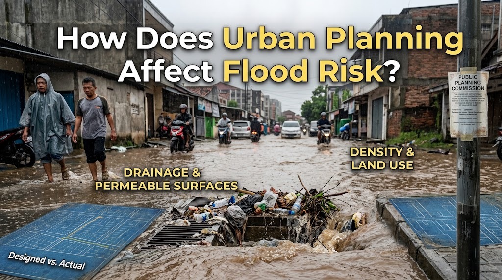
Urban planning has a major influence on flood risk because decisions about land use, infrastructure, drainage, and development determine how rainwater moves through a city. Well-planned urban areas can provide enough space for water to be absorbed, stored, and safely transported away. Poor planning can increase flooding by allowing construction in vulnerable locations, reducing natural drainage areas, and placing excessive pressure on existing infrastructure. Therefore, effective urban planning is an important part of preventing and managing urban flooding.
LAND USE DETERMINES FLOOD EXPOSURE
Land-use planning determines where homes, businesses, roads, industries, and public facilities are built. Constructing buildings in floodplains, wetlands, riverbanks, and other low-lying areas can increase the number of people and properties exposed to flooding.
Careful planning can reduce this exposure by limiting development in high-risk locations or requiring appropriate flood-resistant designs. Authorities can also designate certain areas for parks, retention ponds, or other uses that allow excess water to accumulate safely. These decisions can reduce the potential damage caused by heavy rainfall.
IMPERMEABLE SURFACES INCREASE RUNOFF
Urban planning influences how much land is covered by concrete, asphalt, rooftops, and other impermeable materials. These surfaces prevent rainfall from infiltrating the soil and increase the amount of water flowing across the ground.
If development covers too much natural land without adequate stormwater controls, drainage systems may receive excessive runoff. Urban plans can address this problem by incorporating permeable pavement, green spaces, rain gardens, and other features that allow more water to infiltrate or be temporarily stored.
DRAINAGE INFRASTRUCTURE MUST MATCH URBAN GROWTH
Effective urban planning requires drainage systems to be considered alongside population growth and new construction. As cities expand, more buildings and roads can generate additional stormwater runoff. If drainage infrastructure remains unchanged, its capacity may eventually become insufficient.
Planning authorities can estimate future runoff and determine whether existing drains, pipes, canals, culverts, and pumping facilities can handle projected demand. Upgrading infrastructure before serious problems develop is generally more effective than repeatedly repairing damage after major floods.
NATURAL WATER STORAGE REDUCES FLOOD PRESSURE
Urban planning can protect natural areas that help manage excess rainfall. Wetlands, floodplains, forests, open soil, and vegetation can absorb or temporarily store water before it reaches drainage networks and rivers.
Preserving these areas can reduce the speed and volume of stormwater entering developed neighborhoods. Cities can also create artificial retention ponds, reservoirs, and flood-storage areas when natural space is limited. Combining natural and engineered solutions can provide additional protection during intense rainfall.
ROAD AND TRANSPORTATION DESIGN AFFECTS WATER FLOW
Roads can influence how water moves through an urban area. Poorly designed roads may block natural drainage routes or direct large amounts of runoff toward residential areas. Low points in road networks can also become places where water accumulates.
Urban planners can incorporate adequate roadside drains, culverts, bridges, elevated road sections, and safe water crossings into transportation projects. Designing roads together with stormwater systems helps prevent transportation infrastructure from becoming an obstacle to effective drainage.
DEVELOPMENT NEAR RIVERS REQUIRES CAREFUL PLANNING
Rivers naturally expand beyond their normal channels during major rainfall events. When urban development occupies floodplains or restricts river corridors, there is less space for excess water to spread safely.
Urban planning can establish setbacks from riverbanks and protect floodplain areas from inappropriate development. Restoring natural river corridors can also improve the ability of waterways to accommodate high flows. These measures can reduce both flood exposure and pressure on artificial drainage systems.
BUILDING REGULATIONS CAN REDUCE FLOOD DAMAGE
Urban planning can include building standards that make structures more resistant to flooding. Regulations may require elevated floors, flood-resistant materials, protected electrical systems, or appropriate drainage around buildings in vulnerable locations.
Such measures do not necessarily prevent flooding, but they can reduce the amount of damage when water enters a property. Building requirements should be based on local flood hazards and supported by accurate information about water levels and expected risks.
GREEN INFRASTRUCTURE SUPPORTS FLOOD MANAGEMENT
Green infrastructure uses natural processes to manage stormwater within developed areas. Examples include green roofs, rain gardens, bioswales, permeable surfaces, urban trees, and vegetated drainage channels.
These features can slow runoff, increase infiltration, and temporarily store rainfall. Incorporating them into streets, parks, residential developments, and commercial areas can reduce pressure on conventional drainage systems. Green infrastructure can also provide additional benefits such as improved urban biodiversity and recreational space.
POOR PLANNING CAN CREATE UNEQUAL FLOOD RISKS
Flood risk is not always distributed equally across a city. Lower-income communities may be more likely to live in areas with inadequate drainage, flood-prone land, or limited infrastructure investment. Poorly planned development can therefore increase existing social inequalities.
Inclusive urban planning should consider the needs of vulnerable residents when designing flood-control projects and relocating development. Improving drainage and flood protection in underserved neighborhoods can help ensure that safety measures benefit the entire urban population.
URBAN PLANNING IN INDONESIA
Urban planning is particularly important for Indonesian cities because many face combinations of heavy seasonal rainfall, rapid development, river flooding, coastal hazards, and drainage limitations. In some areas, land subsidence can further increase vulnerability.
Cities can reduce these risks by integrating flood assessments into development plans, protecting water catchment areas, improving drainage networks, maintaining waterways, and controlling construction in high-risk zones. Coordinating local governments, developers, communities, and environmental authorities is essential because flood risks often extend across administrative boundaries.
CONCLUSION
Urban planning affects flood risk by determining where development occurs, how much land remains available for water absorption, and whether drainage and flood-control infrastructure can handle future conditions. Protecting natural water-storage areas, controlling development in vulnerable locations, improving drainage, and using green infrastructure can reduce flood exposure and damage. Poor planning, on the other hand, can increase runoff and place communities in unsafe areas. Integrating flood management into long-term urban development allows cities to become safer and more resilient while continuing to grow.
Recent Posts

Bagaimana Sistem SKS pada Program Kuliah... 22.11.2026/53 View

How Does Technology Make Daily Evaluation... 21.11.2026/82 View

Apa Strategi Menghadapi Kesenjangan antara Kompetensi... 21.11.2026/81 View

Mengapa Inventaris Aset Penting bagi Kelancaran... 21.11.2026/77 View

When Should Musicians Join a Record... 21.11.2026/82 View
