

What Is the Link Between Urbanization and Flooding?
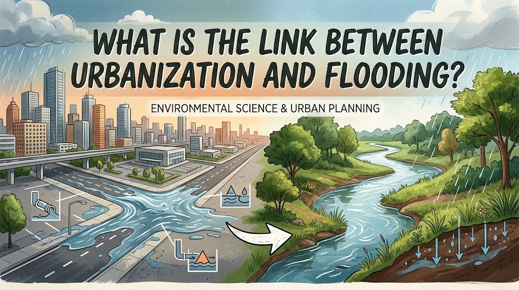
Urbanization is the process through which cities expand as more people move into urban areas and residential, commercial, and industrial developments increase. This process supports economic growth, creates employment opportunities, and improves access to public services. However, rapid urbanization can also increase the risk of flooding when development exceeds the capacity of drainage systems and replaces natural landscapes with impermeable surfaces. Understanding the relationship between urbanization and flooding is essential for creating safer, more sustainable cities.
HOW URBANIZATION CHANGES THE NATURAL ENVIRONMENT
Urbanization transforms natural landscapes into developed areas containing roads, buildings, parking lots, and other infrastructure. Before development, soil and vegetation help absorb rainfall and slow the movement of water across the land. These natural processes reduce the amount of runoff entering rivers and drainage channels at one time.
As urban areas expand, forests, grasslands, wetlands, and agricultural land may be replaced by constructed surfaces. This reduces the landscape's ability to absorb and temporarily store rainwater. Consequently, a greater volume of water may flow across the surface during rainfall, increasing the potential for flooding in developed neighborhoods and surrounding areas.
THE ROLE OF IMPERMEABLE SURFACES IN URBAN FLOODING
Impermeable surfaces are materials that prevent or significantly limit water from entering the soil. Concrete, asphalt, rooftops, and paved sidewalks are common examples found in urban environments. These surfaces are necessary for transportation and construction, but their widespread use can change how rainwater moves through a city.
When rainfall lands on impermeable surfaces, much of the water becomes surface runoff rather than infiltrating the ground. This runoff can travel quickly toward low-lying areas, drains, canals, and rivers. If large amounts of runoff arrive simultaneously, drainage systems may become overwhelmed, causing water to accumulate on streets and enter nearby buildings.
RAPID POPULATION GROWTH AND PRESSURE ON DRAINAGE SYSTEMS
Urbanization often brings population growth, increasing demand for housing, transportation, sanitation, and other public services. As more people settle in a city, additional residential areas and commercial facilities may be constructed. The resulting development can increase the amount of rainwater that drainage systems must manage.
When infrastructure expansion does not keep pace with urban growth, existing drains and canals may become insufficient. Narrow channels, damaged pipes, poor maintenance, and waste accumulation can further reduce their capacity. During heavy rainfall, these weaknesses can contribute to overflowing drains, flooded roads, and water entering residential neighborhoods.
THE LOSS OF GREEN SPACES AND WETLANDS
Green spaces and wetlands help regulate the movement of water through urban environments. Vegetation slows runoff, while soil and natural depressions allow rainwater to infiltrate or remain temporarily stored. Wetlands and floodplains can also accommodate excess water during certain flood events.
Unplanned urban expansion may reduce these natural areas as land is converted for buildings, roads, and industrial facilities. Losing these spaces limits the city's natural capacity to manage rainfall. Protecting parks, restoring wetlands, and preserving river floodplains can help reduce runoff and complement conventional flood-control infrastructure.
CONSTRUCTION IN FLOOD-PRONE AREAS
As cities expand, development may extend into low-lying neighborhoods, riverbanks, coastal zones, and natural floodplains. These locations can be attractive for housing and commercial activities because of their accessibility or available land. However, building in areas that naturally collect or convey water can expose more people and property to flooding.
Construction in flood-prone locations may also obstruct water pathways or reduce the space available for rivers to overflow safely. When buildings and roads occupy natural drainage routes, water can be redirected into surrounding communities. Flood hazard maps, land-use regulations, and careful development assessments can help governments identify and manage these risks.
HOW URBANIZATION CAN INCREASE FLASH FLOODS
Flash floods occur when water accumulates rapidly, often following intense rainfall. Urban areas can be particularly vulnerable because paved surfaces allow runoff to move quickly, while drainage networks may have limited capacity. Steep streets, underpasses, and low-lying intersections can become dangerous when water gathers faster than it can drain away.
Rapid urban development can increase the likelihood of these conditions by expanding paved areas and reducing natural water storage. Flash flooding can interrupt transportation, damage vehicles and buildings, and threaten pedestrians. Although urbanization is not the only cause of flash floods, poorly planned development can intensify their effects.
THE EFFECTS OF URBAN FLOODING ON COMMUNITIES
Flooding associated with urbanization can create serious social and economic consequences. Water may damage houses, schools, shops, roads, electrical equipment, and public transportation systems. When roads become impassable, people may struggle to reach work, medical services, and educational facilities.
Floodwater can also carry waste and pollutants into homes, rivers, and public spaces, creating sanitation problems. Low-income households and people living in informal settlements may face greater risks because their homes can be located in exposed areas or built with limited flood protection. Effective urban planning should therefore consider both physical flood hazards and the needs of vulnerable communities.
THE INFLUENCE OF CLIMATE CHANGE ON URBANIZATION AND FLOODING
Climate change can increase flood risks in many urban areas by intensifying certain heavy rainfall events and raising sea levels along coastlines. When these hazards occur in cities with extensive paved surfaces, limited green spaces, and inadequate drainage, the effects may become more severe. Coastal cities may face additional challenges when high sea levels slow the discharge of rainwater into the sea.
Urbanization and climate change interact in ways that require coordinated planning. Cities need to assess both current flood hazards and possible future changes in rainfall, river flows, and coastal conditions. Climate-informed infrastructure design can help ensure that drainage networks and flood-control facilities remain suitable as environmental conditions change.
STRATEGIES FOR REDUCING FLOODING IN URBAN AREAS
Governments can reduce flood risks by improving drainage systems, maintaining rivers, and developing appropriate flood-control infrastructure. Urban planning regulations can protect floodplains, limit development in high-risk areas, and require new projects to manage stormwater effectively. These measures help address the causes of flooding while reducing the exposure of people and property.
Nature-based solutions can provide additional benefits. Rain gardens, permeable pavements, green roofs, urban trees, and retention ponds can slow runoff or temporarily store rainwater. Community participation also matters because responsible waste disposal, reporting blocked drains, and following flood warnings can support broader prevention efforts.
THE IMPORTANCE OF SUSTAINABLE URBAN DEVELOPMENT
Sustainable urban development balances economic and population growth with environmental protection and public safety. Instead of replacing every available open space with construction, planners can preserve green corridors, protect wetlands, and design neighborhoods that allow rainwater to be managed safely. New infrastructure should be planned alongside population growth rather than added only after flooding becomes a recurring problem.
Cooperation among governments, developers, engineers, and residents is essential for achieving these goals. Long-term planning, reliable funding, environmental assessments, and regular infrastructure maintenance can help cities manage flood risks more effectively. By considering water movement at the planning stage, urban areas can grow while reducing avoidable damage to communities and the environment.
CONCLUSION
Urbanization and flooding are closely connected because urban expansion changes natural landscapes, increases impermeable surfaces, and places additional pressure on drainage systems. Unplanned development can also remove green spaces and expose more people to hazards by occupying flood-prone areas. However, flooding is not an unavoidable consequence of urban growth. Sustainable land-use planning, improved drainage, nature-based solutions, and community preparedness can help cities accommodate development while reducing flood risks.
Recent Posts

Bagaimana Sistem SKS pada Program Kuliah... 22.11.2026/54 View

How Does Technology Make Daily Evaluation... 21.11.2026/83 View

Apa Strategi Menghadapi Kesenjangan antara Kompetensi... 21.11.2026/81 View

Mengapa Inventaris Aset Penting bagi Kelancaran... 21.11.2026/78 View

When Should Musicians Join a Record... 21.11.2026/82 View
