

Why Can The Transitional Season Bring Heavy Rain And Strong Winds?
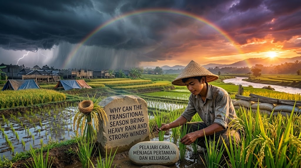
The transitional season, also known as the changeover between the rainy and dry seasons, often brings unpredictable weather. In Indonesia, this period can feature hot sunshine, cloudy skies, sudden heavy rain, lightning, and strong winds within a short time. These conditions occur because atmospheric conditions and wind patterns are changing, affecting how clouds form and move. Differences in temperature, humidity, and air pressure can contribute to the development of rain clouds and thunderstorms. Understanding why heavy rain and strong winds occur during this season can help people recognize weather risks and prepare for sudden changes.
CHANGES IN WIND DIRECTION AND WEATHER PATTERNS
During the transitional season, wind direction and atmospheric circulation can change as regional weather patterns shift between the monsoon seasons. In Indonesia, monsoon winds play an important role in determining whether an area receives more moisture or drier air. As these patterns change, air with different levels of humidity and temperature may meet over certain regions. These changes can influence cloud development and rainfall distribution. However, the exact weather conditions depend on the location, time of year, and wider atmospheric systems.
Changing winds can also affect how clouds and storms move across an area. When moist air is carried toward land, it may contribute to cloud formation, especially when other conditions support rising air. Stronger pressure differences can increase wind speeds, sometimes producing gusts that may damage trees, roofs, and outdoor structures. Local conditions, including coastlines and mountains, can further influence wind direction and speed. Changing wind patterns are one factor behind unpredictable transitional-season weather, but they do not automatically cause heavy rain or strong winds everywhere.
HIGH HUMIDITY AND THE FORMATION OF RAIN CLOUDS
Moist air is an important ingredient in heavy rainfall. During the transitional season, warm air near the ground can rise and carry water vapor into the atmosphere. As the air rises, it expands and cools, allowing water vapor to condense into tiny water droplets or ice particles. When these particles grow large enough, they fall as rain. If rising air continues to supply moisture to developing clouds, rainfall can become heavy.
Indonesia's warm, humid environment can support the growth of tall storm clouds known as cumulonimbus clouds. These clouds are often associated with thunderstorms, intense rainfall, lightning, and strong gusts of wind. However, high humidity alone does not guarantee heavy rain because atmospheric instability, lifting mechanisms, and other conditions also influence storm development. During the transitional season, favorable conditions may develop quickly in the afternoon or evening. This is one reason rain can begin suddenly after a period of hot weather.
HOT WEATHER CAN TRIGGER STRONG UPWARD AIR MOVEMENT
Hot sunshine can warm the ground and the air close to the surface. The warmed air becomes less dense than the surrounding air and may rise, a process called convection. As this air rises, it can cool and form clouds if enough moisture is present. When the atmosphere is unstable, rising air may continue moving upward and help thunderstorms develop. This process is common in tropical regions, including Indonesia, particularly when local weather conditions are favorable.
Thunderstorms can produce strong winds through the movement of air inside and around storm clouds. As rain falls, some air is cooled and pulled downward, creating a downdraft that can spread outward when it reaches the ground. This movement may produce sudden, powerful gusts known as outflow winds. In some cases, these winds arrive before the rain reaches a particular location, making the weather change unexpectedly. Strong winds are therefore not caused only by changes in the general wind direction; they can also develop from processes inside thunderstorms.
DIFFERENCES IN AIR PRESSURE CAN STRENGTHEN WINDS
Air pressure differences help drive wind. Air generally moves from areas of higher pressure toward areas of lower pressure, and larger pressure differences over a given distance can produce stronger winds. During unsettled weather, pressure patterns may change as storms develop and move through an area. These changes can influence local wind speed and direction. However, the strength of the wind also depends on factors such as storm structure, surface conditions, and the surrounding atmospheric circulation.
Thunderstorms may create additional local pressure changes that contribute to gusty winds. Strong downdrafts can spread outward across the ground, producing brief periods of intense wind even when the wider weather pattern is relatively calm. When these gusts occur near homes, roads, or trees, they can cause fallen branches, flying debris, and damage to weak structures. Sudden wind gusts can be dangerous even when they do not last long. People should pay attention to official weather warnings rather than judging the risk only by how calm the weather appears beforehand.
LOCAL GEOGRAPHY CAN INFLUENCE HEAVY RAIN
Indonesia's geography also helps explain why rainfall can vary greatly between locations. Mountains can force moist air to rise, cool, and condense, a process known as orographic lifting. This can increase rainfall on windward slopes when moist air flows toward the mountains. Coastal areas may also experience local wind patterns caused by differences in how quickly land and sea heat up. These local effects can help trigger clouds and thunderstorms when moisture and atmospheric instability are present.
In some places, sea breezes and air movement from different directions can meet, encouraging air to rise and form clouds. This process is known as convergence and can contribute to thunderstorm development. As a result, one neighborhood may experience heavy rain while another nearby area receives only light rain or remains dry. Local geography does not guarantee extreme weather, but it can influence where and when storms develop. These differences make transitional-season weather especially difficult to predict from general conditions alone.
WHY HEAVY RAIN AND STRONG WINDS CAN OCCUR TOGETHER
Heavy rain and strong winds often occur together when thunderstorms develop. Inside a storm cloud, warm moist air rises while cooler air and falling precipitation move downward. These opposing movements can create powerful air circulation, and downdrafts may produce strong gusts near the ground. Lightning and thunder may accompany these storms because of electrical activity within the clouds. The combination of intense rain, poor visibility, and sudden wind gusts can make outdoor activities and travel more dangerous.
Not every period of heavy rain produces strong winds, and not every windy day brings heavy rainfall. Some storms mainly produce intense precipitation, while others generate stronger gusts depending on their structure and the surrounding atmospheric conditions. Heavy rain may also occur without thunderstorms when large areas of moist air rise over a longer period. The relationship between rainfall and wind depends on the type of weather system involved. Understanding this difference helps explain why transitional-season weather can vary from one day or location to another.
HOW TO STAY SAFE DURING EXTREME WEATHER
Because weather can change quickly, people should check official forecasts and warnings, including updates from Indonesia's Meteorology, Climatology, and Geophysics Agency, known as BMKG. Before traveling or planning outdoor activities, pay attention to warnings about heavy rain, thunderstorms, and strong winds. Secure loose objects around the home, clean drainage channels, and check for roof damage before severe weather occurs. These preparations can reduce the risk of property damage and help people respond more effectively. It is also useful to keep a flashlight, a charged phone, and basic emergency supplies available.
When thunderstorms approach, move indoors and stay away from exposed areas, isolated trees, and open fields. Avoid standing near windows during strong winds, and do not shelter under trees during lightning. If flooding occurs, never walk or drive through water when its depth or current is unknown. Follow instructions from local authorities, especially when evacuation is advised. Early preparation and reliable weather information can help protect lives and property during the unpredictable transitional season.
CONCLUSION
The transitional season can bring heavy rain and strong winds because several weather processes may occur at the same time. Changing wind patterns, high humidity, rising warm air, pressure differences, and local geography can all influence cloud formation and storm development. When thunderstorms grow, their internal air movements may produce intense rainfall, lightning, and sudden wind gusts. These conditions vary by location, so extreme weather does not occur everywhere in the same way. By understanding these causes, checking official forecasts, and following safety advice, people can better prepare for changing weather during the transitional season.
Recent Posts

Bagaimana Sistem SKS pada Program Kuliah... 22.11.2026/54 View

How Does Technology Make Daily Evaluation... 21.11.2026/83 View

Apa Strategi Menghadapi Kesenjangan antara Kompetensi... 21.11.2026/81 View

Mengapa Inventaris Aset Penting bagi Kelancaran... 21.11.2026/78 View

When Should Musicians Join a Record... 21.11.2026/82 View
