

Why Does Land Conversion Increase Flooding in Cities?
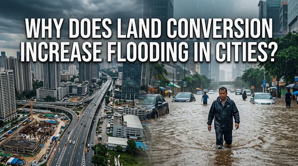
Land conversion is the process of changing natural or agricultural areas into residential neighborhoods, commercial buildings, industrial facilities, roads, and other developed spaces. Although this process supports economic growth and urban expansion, it can significantly increase the risk of flooding when it is not managed properly. Natural landscapes help absorb rainwater, while developed areas often prevent water from entering the soil. Understanding how land conversion affects the movement of rainwater is essential for creating safer and more sustainable cities.
HOW LAND CONVERSION CHANGES NATURAL SURFACES
Natural landscapes, such as forests, grasslands, wetlands, and agricultural fields, help regulate the movement of rainwater. Soil, vegetation, and natural depressions allow water to infiltrate the ground or collect temporarily before flowing into rivers and streams. These processes reduce the amount of water that moves rapidly across the land during rainfall.
When natural areas are converted into buildings, roads, and parking lots, these water-management functions become limited. Concrete and asphalt prevent much of the rainwater from soaking into the ground, causing more water to flow over the surface. Consequently, urban areas may experience faster water accumulation, particularly during heavy rainfall.
REDUCED WATER INFILTRATION INTO THE SOIL
Water infiltration occurs when rainwater moves from the ground surface into the soil. This process helps replenish groundwater and reduces the volume of water flowing directly into drainage channels. Healthy soil with sufficient vegetation and open space can absorb substantial amounts of rainfall, depending on its structure, moisture level, and local conditions.
Land conversion often reduces infiltration by covering the soil with impermeable materials or compacting it with heavy machinery. Compacted soil contains fewer spaces through which water can move, making it harder for rainfall to penetrate the ground. As infiltration decreases, more water becomes surface runoff, increasing the likelihood of flooding in surrounding streets and neighborhoods.
INCREASED SURFACE RUNOFF IN URBAN AREAS
Surface runoff refers to rainwater that flows across the ground instead of infiltrating the soil. In areas with extensive paved surfaces, runoff can develop quickly because water has fewer opportunities to enter the ground. This rapid movement can carry large volumes of water toward low-lying areas, drainage channels, and rivers.
When several neighborhoods experience heavy rainfall simultaneously, their combined runoff can place considerable pressure on urban drainage systems. If the volume of water exceeds the system's capacity, drains may overflow and streets can become inundated. Poorly planned land conversion can therefore increase flood risks beyond the specific location where construction occurs.
THE LOSS OF FORESTS AND GREEN SPACES
Forests and green spaces play an important role in reducing flood risks. Tree canopies intercept some rainfall, vegetation slows water movement, and plant roots help maintain soil structure. These features can reduce runoff and support infiltration, although their effectiveness depends on rainfall intensity, soil conditions, and landscape characteristics.
Converting forests, parks, and other vegetated areas into developed land reduces these natural benefits. The loss of vegetation can also increase soil erosion, allowing sediment to enter rivers and drainage channels. Over time, sediment accumulation may reduce the capacity of waterways to carry floodwater, creating additional challenges for urban flood management.
WETLAND DESTRUCTION AND REDUCED WATER STORAGE
Wetlands, floodplains, and natural depressions can temporarily store excess rainwater during storms. By holding water and releasing it gradually, these areas help reduce sudden increases in river levels. They also provide habitats for wildlife and support other environmental functions.
When wetlands are drained or floodplains are filled for construction, cities lose important natural storage areas. Rainwater that would previously have remained in these landscapes may instead flow rapidly into rivers and drainage networks. This can increase the risk of river overflow, especially when intense rainfall affects a large area at the same time.
PRESSURE ON DRAINAGE SYSTEMS AND RIVERS
Urban drainage systems are designed to collect and transport rainwater away from developed areas. However, widespread land conversion can increase the amount and speed of runoff entering these systems. If drains, canals, pumps, and retention ponds are not designed or upgraded to handle the additional volume, water can accumulate in residential and commercial districts.
Construction near rivers can create further problems when it narrows waterways, removes riverbank vegetation, or occupies areas that naturally accommodate overflowing water. Waste and sediment may also obstruct drainage channels, making flood conditions worse. Effective land-use planning must therefore consider the entire drainage basin rather than focusing only on individual construction sites.
THE EFFECTS ON COMMUNITIES AND THE ENVIRONMENT
Increased flooding can damage homes, roads, schools, public facilities, and business premises. Floodwater may disrupt transportation, interrupt educational activities, and force residents to leave their homes temporarily. Businesses can also face financial losses because of damaged equipment, interrupted operations, and reduced customer access.
Land conversion can also contribute to environmental problems beyond flooding. The removal of vegetation may increase erosion, reduce biodiversity, and affect local water quality. When runoff carries oil, chemicals, and waste from developed surfaces into waterways, it can contaminate rivers and other water sources. These combined effects demonstrate why development decisions should consider both economic benefits and environmental consequences.
STRATEGIES TO REDUCE FLOODING CAUSED BY LAND CONVERSION
Cities can reduce flood risks by controlling development in environmentally sensitive areas and protecting forests, wetlands, and natural floodplains. Land-use regulations should identify high-risk locations and ensure that new projects do not unnecessarily remove important water-absorbing landscapes. Environmental assessments can also help planners understand how proposed developments may affect runoff and downstream communities.
Developers can incorporate green infrastructure, including rain gardens, permeable pavement, green roofs, and vegetated drainage channels. Retention ponds and underground storage facilities can temporarily hold excess rainwater before releasing it safely. These measures are most effective when combined with properly maintained drainage systems, restored waterways, and long-term urban planning.
THE IMPORTANCE OF SUSTAINABLE LAND-USE PLANNING
Sustainable land-use planning balances the need for housing, transportation, industry, and commercial facilities with the protection of natural resources. Instead of allowing development to replace every available open space, city planners can establish green corridors, preserve water catchment areas, and require suitable stormwater management for new construction. These decisions help cities grow while maintaining essential natural processes.
Cooperation among governments, developers, environmental organizations, and residents is necessary to make these strategies successful. Monitoring land-use changes, enforcing building regulations, and educating the public about flood prevention can support better decisions over time. By considering flood risks before land is converted, cities can avoid costly damage and build more resilient communities.
CONCLUSION
Land conversion increases flooding in cities by reducing water infiltration, removing natural storage areas, and increasing the volume of surface runoff. When forests, wetlands, and open land are replaced with buildings and paved surfaces, drainage systems and rivers may struggle to manage excess rainwater. However, thoughtful land-use planning, green infrastructure, and the protection of natural landscapes can help reduce these risks. Responsible urban development allows cities to expand while protecting communities from preventable flooding.
Recent Posts

Bagaimana Sistem SKS pada Program Kuliah... 22.11.2026/54 View

How Does Technology Make Daily Evaluation... 21.11.2026/83 View

Apa Strategi Menghadapi Kesenjangan antara Kompetensi... 21.11.2026/81 View

Mengapa Inventaris Aset Penting bagi Kelancaran... 21.11.2026/78 View

When Should Musicians Join a Record... 21.11.2026/82 View
